A brief history and what to see on
Bonaire
There's more to tell of course, but here's an introduction to our little island paradise...
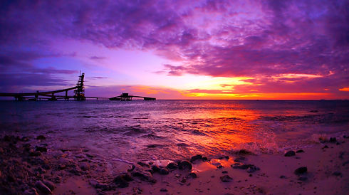
Location, Location, Location
Bonaire is fifty miles north of Venezuela and is part of the Dutch ABC Islands - Aruba, Bonaire and Curacao. It's located below the hurricane belt and is blessed with cooling trade winds across its warm, arid lands. Bonaire is only 112 square miles in size, surrounded by a bountiful Caribbean Sea.


COMMITMENT TO CONSERVATION
Beginning with sea turtle conservation in 1961, the prohibition of spearfishing in 1971, the protection of coral in 1975, a Marine Protected Area since 1979 and named the first Blue Destination in 2017, Bonaire has been at the forefront of protecting its marine environment.
HISTORY
The first known inhabitants of Bonaire were the Caiquetios and you can still see cave drawings in several places. The Spanish first came to Bonaire in 1499 and in 1633 the Dutch took possession of the ABC's and Bonaire became a plantation island belonging to the Dutch East India Company. You can still see old Landhuis (manor houses) at Karpata, Slagbaai and on the southern end of the island.


WASHINGTON SLAAGBAI PARK
The northern end of the island, which used to be two private plantations is now (since 1969) a national park covering 14,000 acres. It was the first nature sanctuary in the Netherlands Antilles. From here you see a more rugged side of Bonaire. You can also hike up Mount Branderis, the highest point on the island at 791 feet above sea level. On a clear day, you can see Curacao.


RINCON
We've always joked that all roads lead to Rincon because when you're diving the north end, you frequently end up there on a one way trip. Nevertheless it's a beautiful town, originally settled in the 1500's. Because it has views to the east and west side of the island, and is in a valley to be less noticeable, it was considered a haven from pirates.